WHAT I'VE BUILT
Portfolio
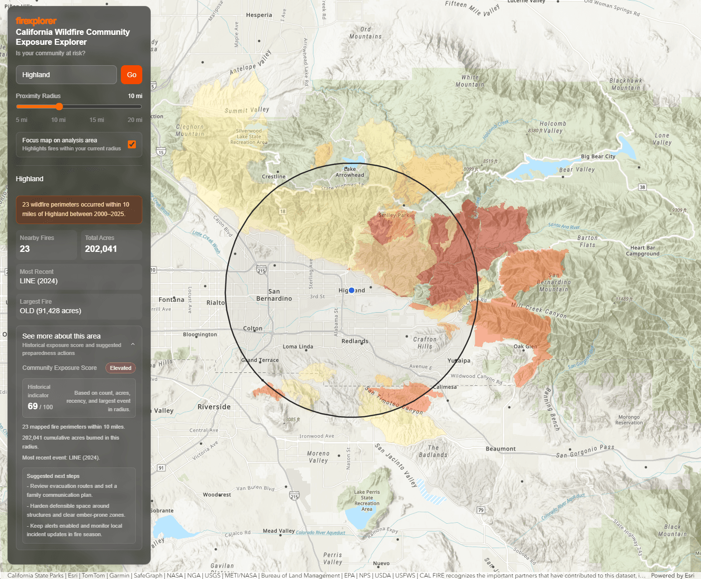
Firexplorer
An interactive wildfire exposure web application for California communities. Users can search any city, adjust a proximity radius, and instantly see 25 years of nearby wildfire activity sourced from CAL FIRE mapped perimeter data. As the map is panned, the data updates in real time — no searching required. Each location receives a risk score based on fire frequency, cumulative acreage burned, and proximity, with safety suggestions tailored to that score.
ArcGIS SDK for JSTypeScriptNext.js